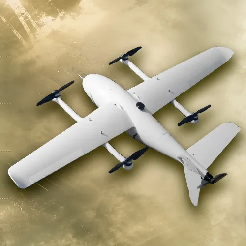
DRONE - B
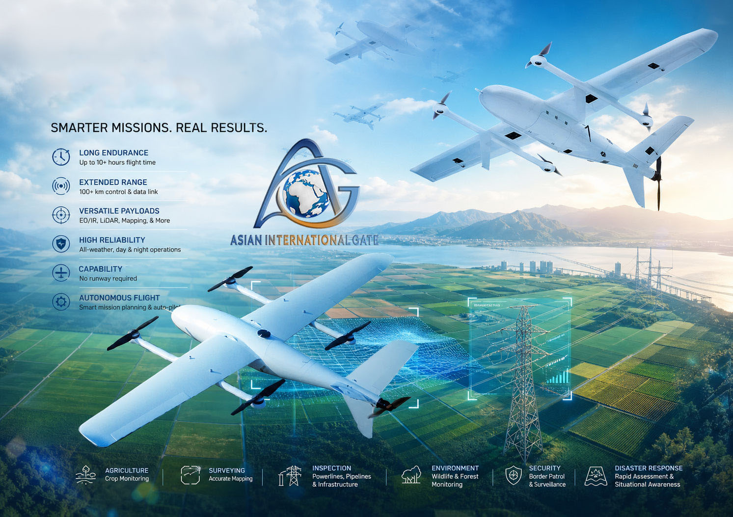
drones-b are unmanned aerial systems that combine the efficiency of fixed-wing aircraft with the vertical takeoff and landing capability of helicopters. They feature fixed wings with multiple propellers that allow them to fly long distances with the ability to stop and hover in one place. They are used for reconnaissance, surveillance, mapping, and even transport or delivery missions in complex environments. They combine tactical flexibility and operational efficiency, making them ideal for military and security operations.
|
|
||
|
DRONE / B |
||
|
|
||
|
INTEGRATED SYSTEM with different types |
||
|
The long-endurance composite wing vertical takeoff and landing drone-b, It adopts a hybrid wing layout combining fixed-wing with quad-copter, resolving the challenges of vertical takeoff and landing for fixed wing UAVs in a simple reliable manner. |
||
|
Vertical takeoff and landing |
||
|
Low Operating Cost |
||
|
Full electric 260 min endurance |
||
|
Max takeoff weight 30 km |
||
|
Datalink from 40 to 100 km |
||
|
|
||
|
DESCRIPTION |
||
|
drones – B are transforming both military and civilian operations in 2026, with breakthroughs in portable battlefield drones, maritime landing systems, and regulatory support for air mobility. They combine the agility of multirotor with the endurance of fixed-wing aircraft, making them versatile for reconnaissance, logistics, and commercial applications. |
||
|
What Drones – B Are |
||
|
Definition: UAVs that can take off and land vertically, eliminating the need for runways. Hybrid Design: Combines fixed-wing efficiency (longer flight times) with multirotor agility (hovering, vertical lift). |
||
|
Applications: Military ISR (intelligence, surveillance, reconnaissance), logistics, agriculture, environmental monitoring, delivery services, and emerging air taxi systems. |
||
|
Key Specifications & Features |
||
|
Design: |
A "tail-pushed" that combines the vertical takeoff and landing capabilities of a multirotor with the efficient, long-range forward flight of a fixed-wing aircraft. |
|
|
Dimensions: |
It features a 2500mm wingspan and is built using a carbon fiber integrated molding process for a lightweight yet durable frame. |
|
|
Flight Performance: |
Maximum Takeoff Weight: Up to 15kg. |
|
|
Navigation: |
A DGPS version is available that utilizes dual GPS modules for high-precision locating and yaw control without needing compass calibration. |
|
|
Versatility: |
The aircraft uses a quick-detach design for the fuselage and cable connectors, allowing for rapid assembly and easy transportation for field |
|
|
Applications |
||
|
The is primarily used in industrial sectors for long-range data collection, including: |
||
|
Public Security and Border Defense: |
Surveillance and monitoring missions. |
|
|
Infrastructure Inspection: |
Inspecting powerlines, railways, and pipelines. |
|
|
Aerial Mapping: |
Loading various cameras or multispectral sensors for high-precision surveys. |
|
|
|
||
|
MAIN TECHNICAL PARAMETERES |
||
|
INTEGRATED VTOL SYSTEM WITH DIFERENT TYPES PAYLOAD |
||
|
PARAMETER |
VALUE |
|
|
Fuselage length |
1.82 m |
|
|
Wingspan |
3.60 m |
|
|
Maximum takeoff weight |
25 kg |
|
|
Maximum payload |
3 kg |
|
|
Endurance |
> 200 min |
|
|
Maximum speed |
120 km/h |
|
|
Cruise speed |
80-95 km/h |
|
|
Saving |
2000 m |
|
|
Maximum wind resistance |
12 m/s (Level 6 wind) |
|
|
ELECTRO OPTICAL SYSTEM (EOS) |
||
|
Full HD EO/LWIR |
||
|
Laser Pointer |
||
|
Automatic Object Tracking |
||
|
Onboard recording and snapshot |
||
|
Moving Target Indicator Advanced |
||
|
GROUND CONTROL STATION (GCS) |
||
|
Data link options for frequency bands |
1.4 GHz * Recommended for long range and best jamming resilience 2.4 GHz |
|
|
Data link Video Interface |
Ethernet |
|
|
Data link Encryption |
AES128/256 |
|
|
Adaptive frequency hopping |
Yes |
|
|
Option for antenna system |
Omnidirectional short range Directional, tracking long range |
|
|
Fly modes |
Auto waypoint/manual |
|
|
Command Control Hardware |
electronics concept board independent of computer and software work alone in sBus channel Datalink for maximum reliability. |
|
|
Software Mission |
Planner |
|
|
Missions planning |
Plan Mission with way-points FULLY automatic Takeoff and landing FULLY automatic mission Can interrupt mission and enter in circle mode to check one detail and come back to continue mission every time Can switch from Automatic fly to manual fly every time |
|
|
|
||